
How a Hampshire County Property Search Starts
Hampshire County's assessment system accepts several starting keys. An address works well when the road name is current. An owner search can pull up multiple parcels, which is common with farms, family trusts, and local businesses. Once another source gives you a full parcel ID, use it to confirm the exact tax record. The property-search form also supports district, map, parcel, sub-parcel, and legal-description lookups.
Begin with the fact you trust most. Then record what comes back: district, map and parcel, legal description, current owner, mailing address, and deed book and page. Confirm the filed instrument in the Clerk's land index. If a tax question remains, take the ticket number to the Sheriff-Treasurer. Remember that search results locate a record. They do not establish clear title.
- Choose Hampshire County and search a street, owner, map, or parcel clue in WV Property Assessment.
- Open the likely card and note its district, legal description, map/parcel, and deed reference.
- Search the County Clerk land index with the current grantee or parcel description.
- Compare the card to the tax ticket and parcel Viewer only for their separate purposes.
- Ask the custodian how to inspect or copy a record that is not available online.
The West Virginia property assessment search page shows the county, owner, street, map/parcel, sales, and advanced search fields. It displays the blank form itself, not a populated Hampshire parcel result.
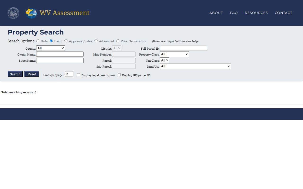
Pick the field that matches the information you hold. Then verify the parcel on its assessment card.
What a Hampshire County Property Result Shows
The Hampshire assessor card spells out the record vocabulary clearly. It separates the place where a property sits from where notices go. It also ties the parcel to its deed book and page, plus sales history. Think of the screen as a tax record view. It is not a copy of the full deed. A real parcel is needed to see actual values.
| CURRENT OWNER | Assessor's present owner-of-record name |
|---|---|
| STREET / MAILING | Property situs and separate notice address |
| MAP / PARCEL | County tax-map key for the parcel card |
| LEGAL DESCRIPTION | Lot terms or other recorded land description |
| DEED BOOK/PAGE | Cross-reference to a land instrument |
| SALES HISTORY | Transfer-related entries shown on the card |
The card has limits. It does not show who occupies a parcel. It does not settle whether every interest has been released. When title matters, read the latest deed. Review any related instruments too. The county assessor-card view is the source for the field names described here.
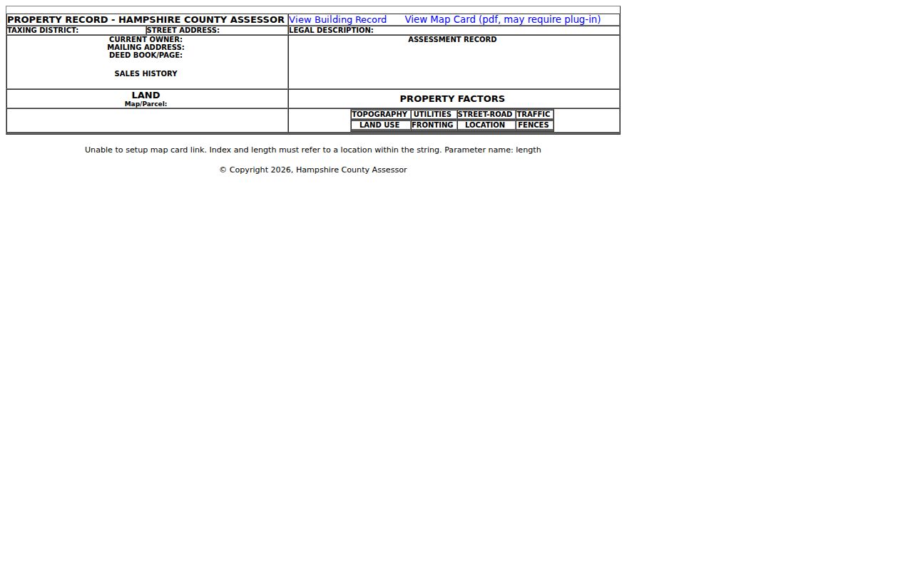
Treat the deed reference as a bridge to the Clerk's index. It is never a substitute for reading the instrument itself.
Street Names in Rural Hampshire
Address is the easiest search key. Hampshire's rural geography can make it the least stable one. Route addresses, post-office names, old roads, and current street labels may all differ. The assessor card separates street address from mailing address and legal description. A tax notice may go out of county. The parcel may sit along a route or valley road.
When a street search fails, try the owner name. The older bill's map and parcel also work. Check the situs against the legal description. Do not treat a ZIP or town name as a boundary. Romney's 26757 and Capon Bridge's 26711 are mailing clues only. USPS lookup verifies a delivery ZIP, not incorporated limits. The parcel district and map number remain stronger record keys than any city name.
For a single address, the USPS ZIP lookup checks the mailing format. It cannot confirm that the tax parcel lies inside a town.
Reading a Hampshire Parcel ID
West Virginia builds a full parcel identifier from six parts. These are the county code, district code, map number, parcel prefix, parcel suffix, and a special ID. The state's example comes from another county. Do not copy that county code into a Hampshire search. Start from a live Hampshire assessment result. Keep the full displayed identifier, including leading zeros and the special ID.
Short forms drop pieces. The GIS ID omits the special ID. CAMA and IAS versions drop the county code. Abbreviated displays may show district-map-parcel or just map-parcel. Copy a parcel key from the current result rather than typing it from memory. A tax map's label can look different from an assessor card. This can happen even for the same property.
Always compare the identifier with the legal description and the recorded deed. If a parcel split after a transfer, the old number may still point to the parent tract. New child parcels can take time to appear on the annual map.
Owner Names in Hampshire Results
An owner search can surface several Hampshire parcels under one name. Spelling and ownership form shape the result. If a search comes back empty, try initials, a middle name, or a known prior name. A business's exact legal name works too. A family trust or LLC may appear as the grantee instead of a person. A matching surname alone never identifies the subject property.
West Virginia's Secretary of State business search helps decode an LLC's legal name. It also shows organization date, status, and registered agent. Those entity fields explain a company record. They do not prove who holds title to a parcel. Return to the deed and match the legal description. Probate or estate transfers may also place fiduciaries or heirs in the land index.
Stay within public property and entity records. The county tax roll names owners of record. It does not name whoever happens to be at an address.
When Hampshire Search Data Lags
The statewide assessment Viewer refreshes just once a year. A recent sale can still show the prior owner. Split parcel lines may lag behind the deed itself. State guidance sets February 1 as the due date for revised map files covering transfers from the July-to-June cycle. If a new line is still missing after two years, ask the assessor.
That lag touches only the map and assessment layer. It never changes a deed's recording date. Keep the instrument reference from closing and compare it with the next assessor update. For title questions, trust the County Clerk record. A stale Viewer label is not proof that a transfer failed.
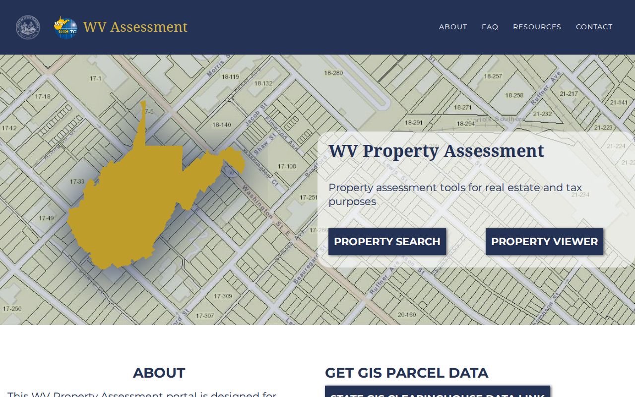
The state's annual-refresh guidance explains the timing and the limits of the map layer. The screenshot shows why the newest deed should be read beside the annual roll.
Need a correction on the assessment card? Contact the Assessor at 304-822-3326 with the parcel key and the supporting instrument.
Following a Hampshire Deed Reference
The DEED BOOK/PAGE field on an assessment card hands you off to the County Clerk. It is not a finished deed search. Bring the reference plus the parcel's legal description and owner name. The land index holds more than deeds. Deeds of trust, releases, liens, plats, assignments, agreements, affidavits, and trustee reports of sale all appear there too. A name-only hit can describe a different property. Compare the instrument's land description before trusting the match.
The public landing page states no verified online cutoff or image charge. If the exact book/page will not open, ask the Clerk about a counter terminal, a plain copy, or a certified copy, and what it costs. The Assessor's card helps here too. It can flag a mismatch between a newer tax parcel and an older parent description. No single web result shows every filed interest.
Chain history needs more than a parcel card. For those questions, use the fuller Hampshire County deed-record reference after the parcel lookup.
When Hampshire Search Needs a Fallback
An empty online result does not mean a Hampshire property or instrument is missing. Roads appear under older names. Owners can surface through an estate or an entity. Some records simply sit outside a portal's display range. Try the full owner spelling, a prior name, the district and parcel, and terms from the legal description. Work one key at a time before narrowing the form with several optional filters.
If none of that works, contact the custodian who holds the record. The County Clerk handles land documents. The Assessor can check the tax card and map key. The Sheriff-Treasurer can search a ticket. A written request under West Virginia's Freedom of Information Act should identify the office, parcel, record type, and date span. For older history, the archive finding aid lists deed-index microfilm from 1756-1969 and deeds from 1757-1901.
Choosing a Hampshire County Search Key
Pick the search key that holds up best over time. A street address suits a known house. An owner name works when the parcel itself is a mystery. For repeating a confirmed match across Hampshire County property records systems, nothing beats the full parcel ID. Remember that a Hampshire mailing city does not always reflect the true municipal location. Route names sometimes change. Before you link one record to another, verify the legal description first.
| Search Key | Best For | Where It Works | Watch Out |
|---|---|---|---|
| Street or route | A known physical location | Assessment form and Viewer | Old or rural addresses may use another label |
| Owner name | Several parcels tied to one tax-roll name | Assessment form; Clerk grantor/grantee search | Entities, estates, spelling, and same names |
| Full parcel ID | Repeatable exact tax-map match | Assessment, Viewer, Auditor search | Shortened formats may omit components |
Not a title search. A Hampshire County property search locates assessment and recording leads. It does not prove that every claim, lien, or unrecorded interest has been resolved.