
Sources for a Hampshire County Block
A Hampshire County block comes together parcel by parcel. The state Property Viewer locates surface tax lots. An assessor card supplies the owner of record for each parcel number, while recorded plats and deeds fill in the subdivision layout and the legal description. None of these records list occupants. Treat every result as a map lead, not a boundary ruling.
| Source | What It Shows About a Block | Access |
|---|---|---|
| WV Property Viewer | Surface tax parcels, district/map labels, flood context | Free state map |
| Hampshire assessment card | CURRENT OWNER, mailing, situs, legal description | State search or county card |
| County Clerk plat index | Recorded subdivision lots and map references | WV Land Records or courthouse request |
| Recorded deed | Legal description and conveyance parties | Clerk index; copy terms not verified |
The WV Property Viewer maps the parcels. Assessor cards name each owner of record, but no county source says who occupies a neighboring lot. The County Clerk page covers plats and other deed records.
Hampshire Viewer Selection Limits
The state viewer lets you search a parcel and study its map context, assessment links, flood layers, and district labels. It offers no select-adjacent, select-by-location, or buffer tool. So the map cannot automatically list every neighbor. You can still identify surrounding surface parcels by reading the interactive map. Note each adjoining tax-map unit one at a time. Confirm its parcel ID through the statewide assessment record before treating it as fact.
A map edge is not a deed line. When a boundary truly matters, trust the recorded legal description. A licensed surveyor makes the final call.
The state parcel viewer shows the official map interface itself, not a selected Hampshire neighbor set.
Orient the block on the map; verify each parcel.
Hampshire Street Search Limits
The statewide assessment form includes a Street Name field. Whether it returns every parcel on a block is another matter, so treat a street query as a lead rather than a verified index. Rural Hampshire roads, route numbers, and mailing addresses often sit in the data under older or inconsistent labels. For a full parcel sequence, open the GIS map and search each visible tax key. Keep the legal description for every result. If an address will not resolve, try the owner. A district and map key from an assessor card works too. An old tax bill can supply that key.
Mapping Hampshire County Parcels Around an Address
Start with the subject property, not a list of nearby names. Open the viewer and locate the surface tax parcel. Read the adjoining parcel keys right off the map. Search each key in the statewide assessment form to confirm the owner of record. Check the separate mailing field there too. The workflow is manual, since the viewer offers no automatic neighbor selection.
- Locate the subject address or parcel in the WV Property Viewer.
- Record its full parcel key and note the adjacent map units visible around it.
- Open each assessment card separately and compare its legal description.
- Use a plat or deed if a shared line or access easement matters.
- Parcel ID
- The tax-map key used to locate one Hampshire parcel.
- Adjacent parcel
- A parcel that appears beside another on the map; the line still needs legal confirmation.
- Plat
- A recorded subdivision map that can name and lay out lots.
- Buffer
- A map radius or selection method; an automated Viewer tool was not verified.
Hampshire City Edges and ZIPs
A mailing city in Hampshire County does not always match the municipality that governs a parcel. Romney carries ZIP 26757 and Capon Bridge carries 26711, yet USPS delivery routes say nothing about town boundaries. Before relying on a city name as a locator, compare the parcel's situs address, its tax district, and the plat or GIS map on file.
The Census incorporated-place roster lists Romney and Capon Bridge as the county's incorporated places. Augusta is simply a community name, not a third incorporated municipality. That two-place picture is the context to keep in mind when you run a nearby-parcel search in Hampshire County.
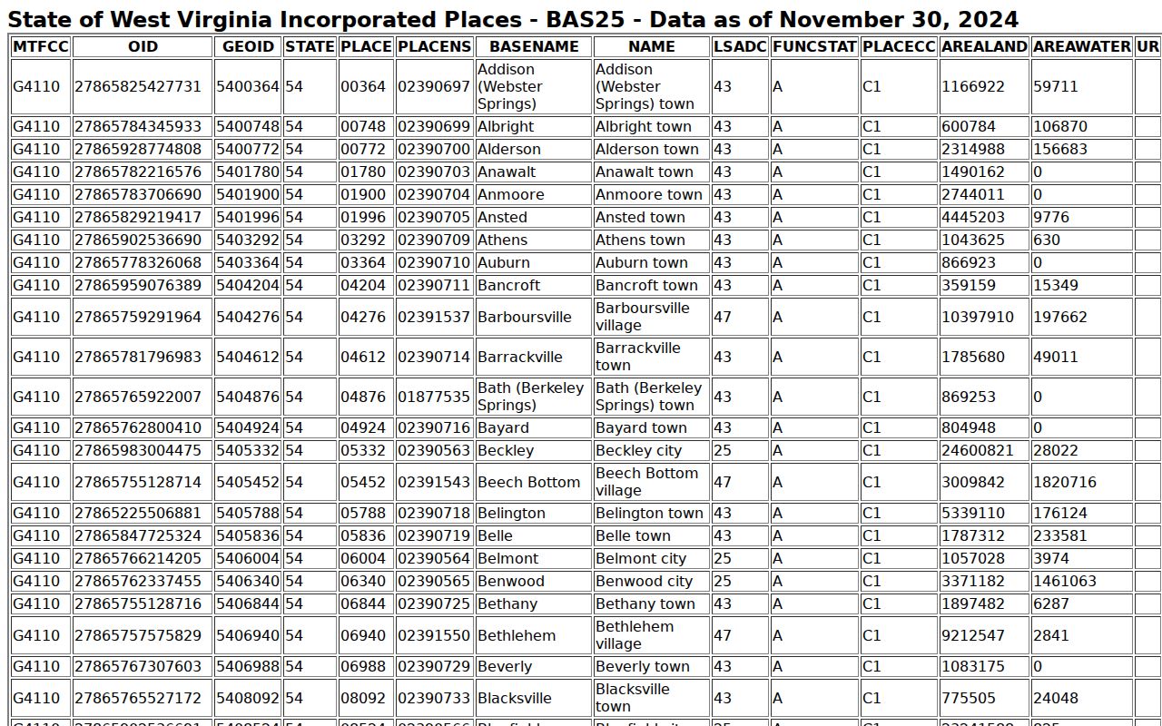
Use the roster as context, not boundary proof. For a single address, the USPS address-to-ZIP lookup confirms postal formatting. It does not establish a municipal limit.
Use the ZIP only as a mailing clue. The parcel number and tax district in Hampshire County records settle the location.
Hampshire Flood and Plat Context
The viewer's flood layers include effective 100-year zones plus advisory and updated overlays. Shading on a neighbor's parcel says nothing about yours. Flood status is parcel by parcel. Overlay questions go to Planning or the floodplain manager, since a map alone is never a site-specific determination. Note the layer name and date first.
For subdivision blocks, the County Clerk's plat index and the Planning approval file show lot layout and permit history. Under the ordinance, a final plat carries a stamped title, date, and signature. A later replat can redraw everything. Old drawings rarely match current parcels.
The Clerk's plat category and County Planning policy identify the records for a specific Hampshire block.
Hampshire Owner and Mailing Fields
An Assessor card lists CURRENT OWNER, STREET ADDRESS, and MAILING ADDRESS as three separate values. That distinction matters. The owner field names the owner of record for a single tax parcel. That name may differ from the mailing address on file. Neither field tells you who actually lives there. A list of owners is never a list of residents. Treat it accordingly when reading Hampshire County property records.
When you pull a nearby parcel, keep the tax ID, legal description, and card reference together as one packet. A recent transfer can leave the owner field lagging behind the deed records. Compare the latest deed before drawing conclusions. The state assessment Viewer updates just once a year. So a simple ownership change may not appear in Hampshire County property records until the next refresh.
Limits of a Hampshire Neighbor Lookup
A Hampshire County neighbor lookup serves map orientation, boundary diligence, and civic research. It works well for that. What it shows are tax parcels and owners of record, not occupants, so Hampshire County property records cannot confirm who lives next door. GIS lines are best-fit reference lines rather than legal boundaries, and protected-address rules plus other exemptions can limit what personal information the property search releases.
Lawful use. Use nearby parcel details only for lawful property and civic purposes. Do not use names or map context to watch, threaten, or harass anyone.