
Starting a Hampshire County Property Search
A Hampshire County property search starts with whatever clue you hold. Knowing that shapes the route. An address or owner name points to the state assessment search. Its result can return a district, map and parcel, legal description, current owner, mailing address, and deed book/page. From there, the County Clerk land index verifies the recorded transfer and any related documents. Keep the parcel key in hand as you move between tools. A tax ticket and a map answer different questions.
Each record has its own job. Use the roll to locate a parcel. Use the deed to confirm the filed transfer. Use the Treasurer to check a tax bill, and GIS for map context. Remember that a search result is not a title report, survey, or appraisal. For older Hampshire land, the online trail may stop before the county archive does.
- Search the West Virginia Property Assessment form by street, owner, or parcel.
- Write down the district, map/parcel, owner field, legal description, and deed reference.
- Use the Hampshire County Clerk index to locate the recorded deed or related filing.
- Check the Sheriff-Treasurer ticket inquiry for payment status, then use the Viewer for map context.
- If a scan or older book is absent online, ask the custodian about the counter, mail, or archive route.
Offices Behind Hampshire County Property Records
Four custodians split the work in Hampshire County. Romney, the county seat, is the main records stop. The Sheriff-Treasurer also runs a tax-services substation at the former Capon Bridge Middle School. That substation handles taxes, not land records. It is neither a second assessor nor a land recorder, so a countywide request there will not replace a deed-index or ticket search with the office that created the record.
Hampshire County Clerk
66 North High Street, PO Box 806
Romney, WV 26757
304-822-5112
Historic Hampshire County Land Books
Hampshire County land books are a genealogist's gift. The archive's year ranges are unusually complete. The finding aid lists land books for 1851-1853, 1856, and 1865-1875, plus eastern and western district books covering 1854-1859. Older still are entry books from 1788-1824 and 1830-1854, a survey book from 1783-1861, and Mitchell surveys from 1788-1803. These volumes can place an old tract when current road names or parcel lines no longer match its earliest description.
Treat the books as research leads, not substitutes for a recorded deed. Ask the archive or Clerk how to request a volume, then compare the land description against the modern assessment map. A survey reference, family name, or stream name may narrow things down. A matching surname alone never identifies the same property.
Before arranging microfilm or archive access, use the Historical Hampshire finding aid to identify the right collection.
Hampshire County's State Search
West Virginia's statewide assessment form offers the broadest documented search choices for Hampshire parcels. Owner and street are only the start. The form also accepts a full parcel ID, district, map number, parcel, and sub-parcel. Tax class, property class, and land use are accepted too. Advanced filters reach appraisal ranges, calculated and deeded acres, sales dates and prices, and flood hazard. Mailing address, deed book/page, legal description, and building details are covered as well. Results can even add a legal description or GIS ID.
Most fields are optional, so start with one clue. Narrow from there. An old route address often works better by street name or owner. A verified tract calls for its parcel ID and district. The West Virginia Property Assessment form is the source for the live search layout. It also covers the field groups.
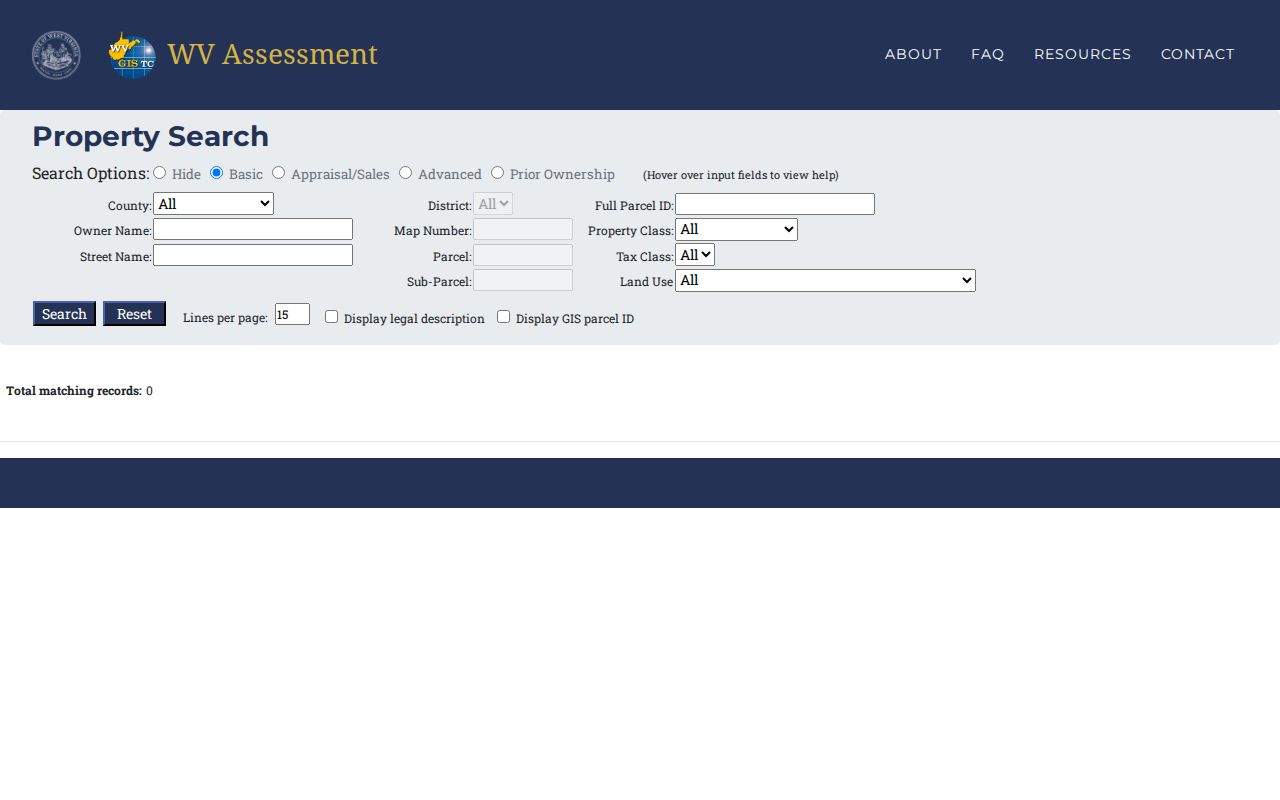
Carry the district and parcel into the Clerk's deed index, so two similar addresses never get confused.
Hampshire County Clerk Record Categories
A sale deed is only one entry on the County Clerk's land page. The page also names deeds of trust, judgment and tax liens, releases, church trustees, cemetery deeds, restricted military discharges, trustee reports of sale or foreclosure, plats, assignments, agreements, and affidavits. Each category can add a layer to a property history. A release may close a prior security instrument. A trustee report may point toward a sale deed. A plat can reveal the lot pattern.
Some questions remain open. The public landing page names no grantor/grantee field list, coverage start, image cutover, or copy price. Ask the Clerk about older books. Do they appear in an in-person terminal? Ask how copies are delivered. The Hampshire land-record landing page is the official entry point. It displays the record categories it covers.
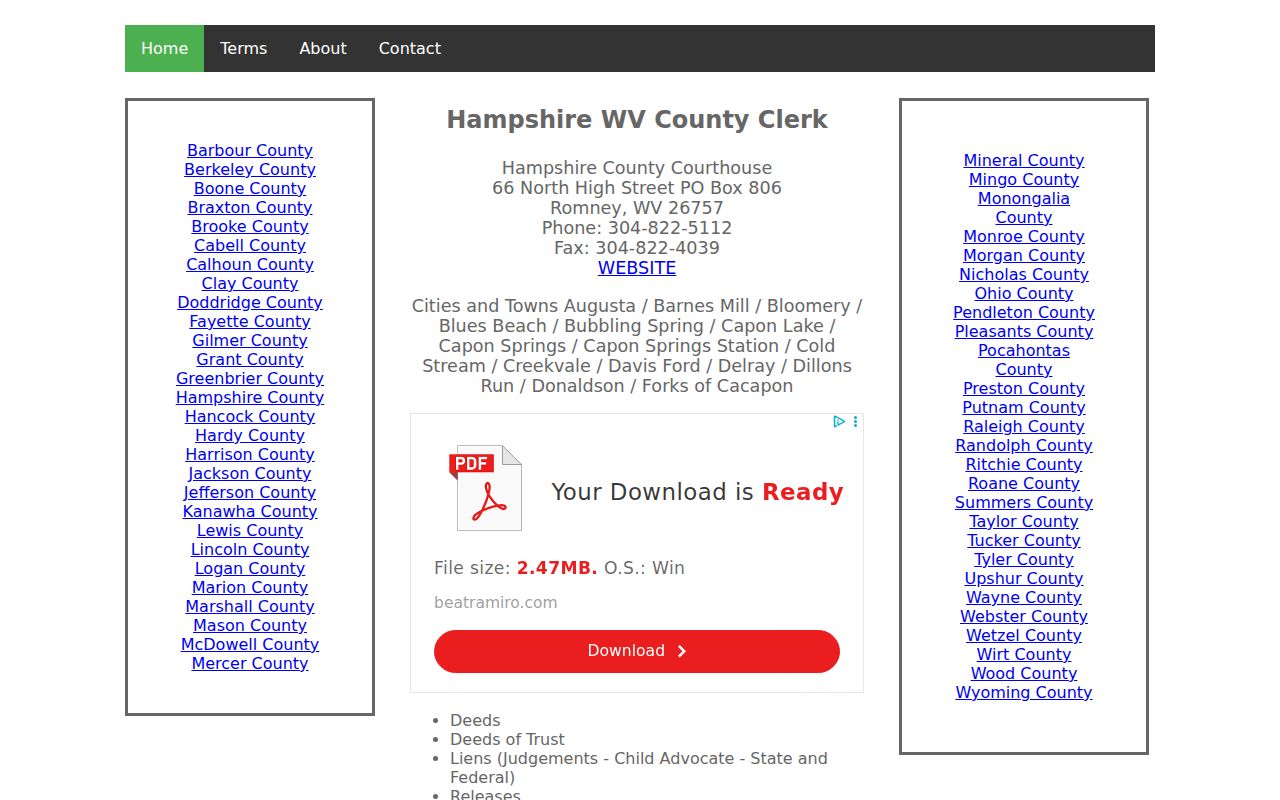
Match the document type to the parties and the legal description. A party name alone can point to another tract.
Hampshire County Assessment Card
The assessor card sorts its clues into four groups: location, ownership, tax, and valuation. CURRENT OWNER and MAILING ADDRESS sit apart from STREET ADDRESS. The card also carries the legal description, deed book/page, sales history, assessment record, and land. It also holds map/parcel and property factors. Those factors cover topography, utilities, street-road, traffic, land use, fronting, location, and fences. Read them to understand the assessor's record. They are not proof that a person receives mail at the property. The linked Hampshire County Assessor card sample shows its field labels. A live property opens with a valid parcel parameter. Save the deed cross-reference and legal description for later confirmation.
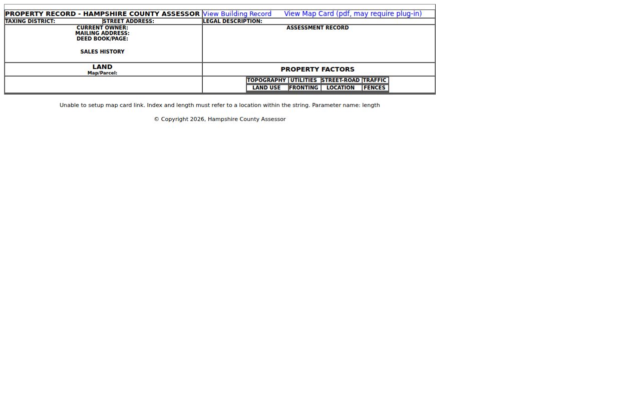
A mismatch between fields on a Hampshire County tax card is a prompt to check the recorded instrument itself. Then ask the Assessor about a correction rather than relying on either figure alone.
Types of Hampshire County Property Records
Hampshire County property research splits across separate offices. The County Clerk holds recorded instruments, the Assessor keeps the parcel and value card, and the Sheriff-Treasurer tracks the tax ticket. State parcel maps round out the set. Each source answers a different question. A deed records the instrument; a tax card reflects assessment fields; a ticket tracks payment; a map helps locate the tax parcel. No single record combines a full title review, tax status, and surveyed boundary, so plan to use more than one Hampshire County property record.
| Record Type | What It Documents | Kept By | Access |
|---|---|---|---|
| Deeds | Filed transfers, grantees, and instrument dates | Hampshire County Clerk | Public index; image and copy charges were not verified |
| Mortgages & liens | Deeds of trust, liens, and releases | Hampshire County Clerk | Public index; image and copy charges were not verified |
| Tax & assessment | Assessed owner, classification, land and improvement values, and tax fields | Hampshire County Assessor and Sheriff-Treasurer | State assessment search and county ticket service; confirm current access terms |
| Plats & parcels | Recorded lot pattern, tax parcel key, and surface-map geometry | County Clerk for plats; WV Property Viewer for tax maps | Online index and map for reference; neither is a survey |
| Building permits | Permit and site-plan history, where held | County Planning or the town office, by jurisdiction | Contact the custodian; no public lookup was located |
Hampshire County deed records let you trace filed transfers and related interests. Turn to property tax records for ticket dates, payments, and delinquency status. The state assessment search adds owner, legal-description, sale, and value fields. Its map viewer supplies spatial context. The Clerk publishes no confirmed online image access or fee schedule, so ask before treating an online index as a complete copy source.
Annual Hampshire County Map Updates
The WV Property Assessment Viewer refreshes with the annual tax assessment release. The state cautions that a recent ownership change may not have filtered through yet. Parcel-line work after a split can take longer. Assessors submit revised maps by February 1 for transfers during the July-to-June assessment period. A new line may lag past two years. If so, the state advises contacting the assessor. This guidance describes the map cycle, not a guaranteed date for every Hampshire record field.
For a recent conveyance, use the recorded deed. For the tax key, use the assessor's map and parcel entry. If the two disagree, note the recording date and the parcel description. Also note the Viewer date. Then ask the Assessor to review the Hampshire County property records involved. A GIS mismatch does not void a deed.
The state assessment guidance sets out the annual refresh and the parcel-line delay. Read it before relying on the map.
For current title work on Hampshire County property, trace the recorded instrument rather than waiting for the map to catch up.
Hampshire County's Tax Ticket Calendar
The Treasurer's ticket holds payment facts the assessor card does not. County statements are mailed around July 15. They use the deed name and address from July 1 of the prior year, unless the tax office has another destination on file. That timing matters. A recently sold parcel can still produce a ticket under a prior name. Ask with the ticket number when checking a balance.
The first half earns a 2.5% discount if paid by September 1. The second half earns the same discount through the following March 1. Delinquency begins after October 1 and the following April 1. Unpaid amounts may be published after April 30. The county page lists card fees at 2.5% with a $2 minimum. E-check costs $2, and returned checks cost $25. The Sheriff-Treasurer tax page is the current inquiry route for Hampshire County property records.
Payment history belongs to the ticket. The latest filed deed is the better record for a new owner of record in Hampshire County.
Hampshire County Viewer Layers
The statewide parcel Viewer combines surface tax parcels with ownership and assessment context. It also adds map bases, flood hazard layers, and district and map labels. Search by address or parcel. Then identify the selected feature and compare its key with the assessment record. The Viewer offers no dedicated adjacent-parcel or buffer tool. Do not count on one. Still, clickable parcel context can help orient a neighbor or boundary question.
WV Tax Division builds its annual master surface tax file. It draws on county GIS and assessment attributes. The state GIS Clearinghouse provides free digital map files, but each remains tax-map data. Surface parcels are shown, while minerals are treated separately. The state notes that calculated acres come from geometry. Deeded acres come from the record. For subdivision detail in Hampshire County, use the Clerk's plat category and Planning's approval material.
Open the WV Property Viewer for map context or the WV GIS Clearinghouse for downloads.
Use the map to find the tax parcel. Then use a deed, plat, or survey for a legal boundary in Hampshire County.
Hampshire County Archives Access
Historical Hampshire's collection is a practical fallback when the live Clerk portal does not reach far enough. The finding aid lists a 1756-1969 deed-index microfilm run and deeds from 1757-1901, plus surveys, land books, entry books, wills, probate, and newspaper clippings. The archive also holds Romney house-history material, Capon Valley research, and older property references. Those collections can connect a modern legal description with an older tract name or owner of record.
A Civil War account says bound records, including land books and wills, were removed from the courthouse and later returned, while some will books are still noted as missing. This is a preservation clue, not a promise that every loose document survives. Identify the item and year in the finding aid before requesting access.
Start with the Historical Hampshire archive guide; it describes years and collections but does not itself provide a searchable deed image for Hampshire County property records.
Hampshire County Flood and Permit Files
Sometimes a property card and the building on the ground disagree. The cause is often old paperwork. A flood overlay or a decades-old permit can reshape what the parcel legally holds, and County Planning's Building Permit Information policy routes applicants to a permit and site plan before work begins. Floodplain approval can be required. Final-plat approval under the subdivision ordinance shows up as a permit stamp. That stamp carries a title, date, and signature.
One caution applies. The named applicant may be a builder or a former owner rather than the owner of record today. For copies, ask Planning for the permit or site-plan file and the County Clerk for the recorded final plat. Compare the parcel number, address, and legal description. Two similarly named lots may not be one property.
Hampshire County offers no online permit lookup or city-run permit portal, so use the custodian route. Confirm fields, fees, and submission methods first. The county permit policy is the documented starting point, and the linked PDF can be requested if it is unavailable online.
The state parcel Viewer shows flood layers. Effective 100-year zones appear alongside advisory and updated overlays. Neither layer is an engineering finding for a single parcel. Hampshire property near a stream, hollow, or low road deserves a closer look through the WV flood tools and the floodplain manager named in the county permit policy.
A map overlay can frame a question. It cannot prove which side of a regulated zone a structure occupies. When a sale or development turns on flood status, record the map date and parcel ID, ask Planning about the site-plan or floodplain review, and seek the official determination from the proper office. The GIS parcel itself remains a tax map. It settles no elevation, drainage, or boundary dispute.
Hampshire County Records Requests
Online indexes are not the whole Hampshire archive. W. Va. Code Chapter 29B sets out a process for requesting public records from the public body that maintains them. The Secretary of State's guidance directs each request to the custodian, not to a central state office that holds no file. Route each question accordingly. Ask the Clerk for a deed or plat. Ask the Assessor about a card correction. The Sheriff-Treasurer handles tickets, and Planning holds permit files.
A clear request names the record first. Add the parcel or address, the date range, and the form of access sought. When a portal lacks an image, ask about inspection, a mailed copy, or a counter terminal, and request the current fee. Clerk copy charges and exact portal image terms are not posted, so confirm them first. Follow the West Virginia FOIA request guidance to reach the correct Hampshire custodian. The act carries exemptions, so sensitive personal details should not be reproduced without need.
Comparing Hampshire Records Access
Hampshire's public resources each have different strengths. The state search and the Viewer work well as online starting points. They support a Hampshire County property search from home. Courthouse and archive routes fill the gaps. They serve better when a historic volume or image is missing. An online view may save a trip. But its limits and charges are not all documented on public landing pages.
| Route | Best use | Limit to check |
|---|---|---|
| State assessment and parcel tools | Find a parcel, owner field, tax map, or layer | Annual refresh and non-survey geometry |
| County Clerk portal | Find deeds, liens, releases, plats, and trustee reports | Index start, image access, and copy fee need confirmation |
| Counter or written request | Older books, non-indexed records, certified copies | Ask the holding office about hours and current fee |
| Historical Hampshire finding aid | Identify deed, survey, land-book, and probate runs | Finding aid does not guarantee each item survived |
Free map downloads help with analysis. They do not replace certified images, title work, or a survey, so pick the channel that matches the record you need.
What Hampshire County Property Records Can and Cannot Tell You
Hampshire County property records answer many questions, but not all of them. A parcel file can show the owner of record, an assessed value, a tax bill balance, or a recorded lien. It cannot prove that a mapped line is a surveyed boundary or that an assessment matches a current sale price. A fresh deed may even appear before the county refreshes its annual assessment or revises the parcel lines on the plat.
Lawful use. Use owner and parcel information for property research, transaction due diligence, and civic review. Confirm title with a qualified title professional, use a licensed surveyor for a legal boundary, and never use record information to stalk, threaten, or harass anyone.